Black Bayou Lake Trail: Boardwalk and Route Choices
- Which Black Bayou Lake trail should you choose?
- Separate the boardwalk, pier and trail names
- Choose by surface and purpose before distance
- Check access without assuming the website is a live status board
- Pack for the actual conditions
- Make heat and lightning decisions before the walk
- Observe habitat without approaching wildlife
- Use an observation record, not a mileage target
- Sources
Which Black Bayou Lake trail should you choose?
For a Black Bayou Lake walk, compare the Nature Trail and Wildlife Pier with the concrete Arboretum and Prairie trails before choosing a route. Official distances describe separate named trails, not a guaranteed combined outing. Confirm current access, surfaces and weather with the refuge, and obey closures. Stay on authorized routes, keep away from wildlife and water edges, and do not begin or continue an exposed walk during thunderstorms.
Black Bayou Lake National Wildlife Refuge is in Monroe, Louisiana. This guide is desk-researched, not an account of a walk we took. Its purpose is to help you choose the right kind of walking visit rather than promise a particular pace, open route or animal sighting.
Separate the boardwalk, pier and trail names
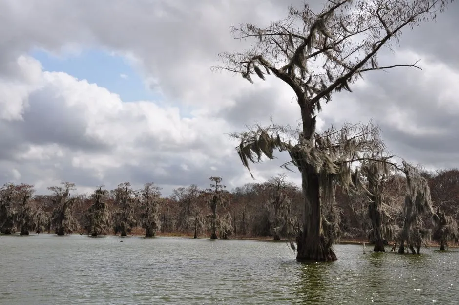
The Fish and Wildlife Service's visit page names the Nature Trail Boardwalk and Wildlife Pier separately. The boardwalk passes through bottomland habitat; the pier extends into the lake. They offer different viewpoints, even when someone describes the whole outing simply as “the boardwalk.”
The agency's trail directory lists these individual lengths:
| Named trail | Listed length | Source-described character |
|---|---|---|
| Nature Trail | 0.61 miles | No character description given in the trail directory |
| Wildlife Pier Trail | 0.39 miles | Wheelchair- and stroller-accessible wildlife-viewing pier |
| Arboretum Trail | 0.38 miles | Concrete loop around the Conservation Learning Center |
| Prairie Trail | 0.20 miles | Concrete loop through a demonstration prairie |
These are the agency's displayed trail lengths, checked September 8, 2026. Do not add them together and label the result a complete route from your parking space. Connections, shared sections and the return to your actual starting point need the current refuge map.
For primitive terrain, the same directory warns that Edgewater Trail sections may hold water after rainfall. That is a different choice from a concrete loop, not simply more of the same surface.
Choose by surface and purpose before distance
If your aim is a forest-edge walk, ask about the Nature Trail's current condition. If it is looking across the lake, ask specifically about the Wildlife Pier. If a concrete surface is important, ask about the Arboretum or Prairie route and its connection from parking.
A wheelchair-friendly listing is useful information, but it does not answer every visitor's needs. Confirm current barriers, surface condition, gradients, resting opportunities and the route between parking, trail and toilet. An accessible trail description does not establish the condition of every connecting path or facility.
Choose one named route as the initial plan. An extension is optional and requires its own access, weather and group-capacity check. A short listed distance is not evidence that an outing is suitable for every child, older adult or person using a mobility aid.
The visitor-center guide handles buildings and essential facilities separately. An outdoor route should not depend on an unconfirmed open building.
Check access without assuming the website is a live status board
The official trail and visit pages describe opportunities, but their listings are not a same-minute inspection. Before departure, check the refuge homepage, current posted notices and staff guidance for closures, maintenance, hunting activity or changed access. Follow barriers and directions on arrival. Do not bypass a closure or improvise a shoreline detour.
There is a published hours discrepancy to resolve. The rules page states 30 minutes before sunrise to 30 minutes after sunset; the services page says sunrise to sunset. Ask the refuge which instructions currently apply rather than using the wider window as permission.
The services page gives [email protected] for questions. Ask about your named route and date, including any essential accessibility requirement. No staff contact or route-status confirmation was obtained for this article.
Pack for the actual conditions
Bring drinking water, sun protection, a current official map and footwear suited to the confirmed surface and recent weather. Closed-toe walking shoes are our practical editorial choice; they do not make flooded or closed ground acceptable.
For mosquitoes, the CDC recommends EPA-registered repellent and loose-fitting, long-sleeved shirts and pants. Follow the product label. Do not use products containing oil of lemon eucalyptus or PMD on children under three. Do not apply repellent to children's hands, eyes, mouth, cuts or irritated skin; an adult should apply it to their own hands before applying it to a child's face.
Pack only what you can manage without compromising movement. Keep hands available where balance or mobility equipment requires them. Binoculars are optional; they are not a reason to lean over a barrier or leave the route.
Make heat and lightning decisions before the walk
Check local National Weather Service forecasts and alerts. During extreme heat, NWS guidance recommends reducing, eliminating or rescheduling strenuous activity to cooler periods. Carry water; people with fluid restrictions should ask their clinician before increasing fluid intake. Shade and a shorter trail do not cancel heat risk.
If someone develops dizziness, weakness or nausea, stop activity and move to a cooler place. Seek immediate medical attention for vomiting, worsening symptoms or symptoms lasting longer than an hour. Suspected heat stroke, including confusion or slurred speech in heat, requires calling 911 and cooling with cool cloths while help arrives; do not give fluids. NWS heat-illness guidance
When thunder is heard, move immediately to a substantial building with electricity or plumbing, or an enclosed metal-topped vehicle with windows up. Remain sheltered at least 30 minutes after the last thunder. A tree, boardwalk or open shelter is not a substitute. NWS lightning guidance
Do not wait to finish a loop, observation or scheduled check before responding to a warning. Know where accessible suitable shelter is before setting out; do not count on a locked visitor center.
Observe habitat without approaching wildlife
The refuge describes bottomland hardwood forest, cypress swamp and lake habitat. A walking visit can focus on their differences: canopy and understory, open water and vegetation, or changes in reflected light. Those are observation prompts, not directions to leave a designated path.
The Fish and Wildlife Service's wildlife-viewing guidance recommends distance, binoculars or a zoom lens, no feeding and no touching. Do not use amplified calls to attract animals. Contact refuge staff about an injured animal rather than handling it.
Keep children closely supervised around the water and on elevated walkways. Stay within permitted pedestrian areas and do not climb barriers. A wildlife sighting does not authorize approaching an animal or entering the water.
Local rules require dogs to be leashed and waste removed. They also prohibit bicycles on boardwalks, the Wildlife Pier, Arboretum and Prairie trails. Check the complete current rules before bringing a dog or bicycle; permission for one activity does not transfer to another.
Use an observation record, not a mileage target
Our original record has four fields:
| Field | Example of what to record |
|---|---|
| Route selected | Exact official name and current map |
| Access checked | Date, notice or staff information; unresolved needs |
| Observation | What you actually saw or heard from the permitted route |
| Decision | Finish the visit, or consider an independently checked extension |
A fictional entry might read: “Prairie Trail considered; concrete surface listed; current parking connection still unconfirmed.” That is an incomplete plan, not a report of an accessible visit.
For families, agree that anyone can request an earlier finish. For birdwatching, leave identification uncertain when necessary: “small bird heard, not identified” is a valid record. Neither purpose requires a minimum distance.
Browse nature near town for related planning and city plans for another confirmed activity when outdoor conditions are unsuitable. The useful result is a visit matched to current conditions, not completion of every line on a map.
Sources
Official FWS refuge, visit, trail, rules, services and wildlife-viewing pages; CDC mosquito prevention; and NWS heat, heat-illness and lightning guidance were opened September 8, 2026 and linked above. Trail listings are descriptive, not a live opening guarantee. No map geometry, combined-route mileage, field inspection or wildlife encounter was invented.